METAR Info
METAR EGSS 270950Z AUTO 32003KT 240V010 9999 NCD 17/07 Q1025
Category: VFR
Wind: 320° at 3 kt
Recomended Runway 28 based on current wind conditions, with a headwind component of 2.3 kt and a crosswind component of 1.9 kt.
EGZD - Blooms Farm
location_onLocation: 1.5 nm NW of Sible Hedingham.
mapMap: Open in Maps
settings_input_antenna Comms
Unicom U 122.800
road Runways
Length: 611 m (2004.59324 ft) close_small 20 m (2004.59324 ft)
Surface: Grass
Headings: 279,99
| Runway | Surface | Length | Width | Lighting | TORA / LDA |
|---|---|---|---|---|---|
| 10 / 28 | Grass |
600 m 1968.504 ft |
22 m 72.17848 ft |
Nil |
TORA: m (0ft) LDA: m (0ft) TORA: m (0ft) LDA: m (0ft) |
altitude Elevation & Pressure
Altitude: 242 ft AMSL
QFE Available: Yes -- Estimated QFE: 1025 hPa
Transition Altitude: 6000 ft
radio Navaids
Name: CLN
Frequency: 114.6 kHz
Notes: R292 23.5DME
description Airfield Notes
Close to Stansted controlled airspace. Squawk 7013 and listen to Stansted Radar 120.625
loop Circuit & Procedures
Circuit Height 1200ft QHN.
volume_off Noise Abatement
Avoid local villages.
report_problem Warning
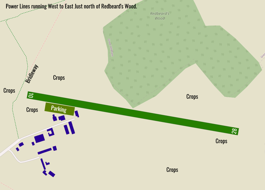
Powerlines north of the airfield running West to East.


Bridleway marks the boundary of Rwy 10 check on approach for horses/pedestrians.
link External Resources
image Images
Ground Layout: