METAR Info
METAR EGNV 271020Z 01006KT 340V050 9999 SCT029 14/07 Q1025
Category: VFR
Wind: 10° at 6 kt
Recomended Runway 30 based on current wind conditions, with a headwind component of 2.1 kt and a crosswind component of 5.6 kt.
EGUK - Peterlee
location_onLocation: 1.8 nm W of Peterlee.
mapMap: Open in Maps
settings_input_antenna Comms
Peterlee drop zone Radio 129.905
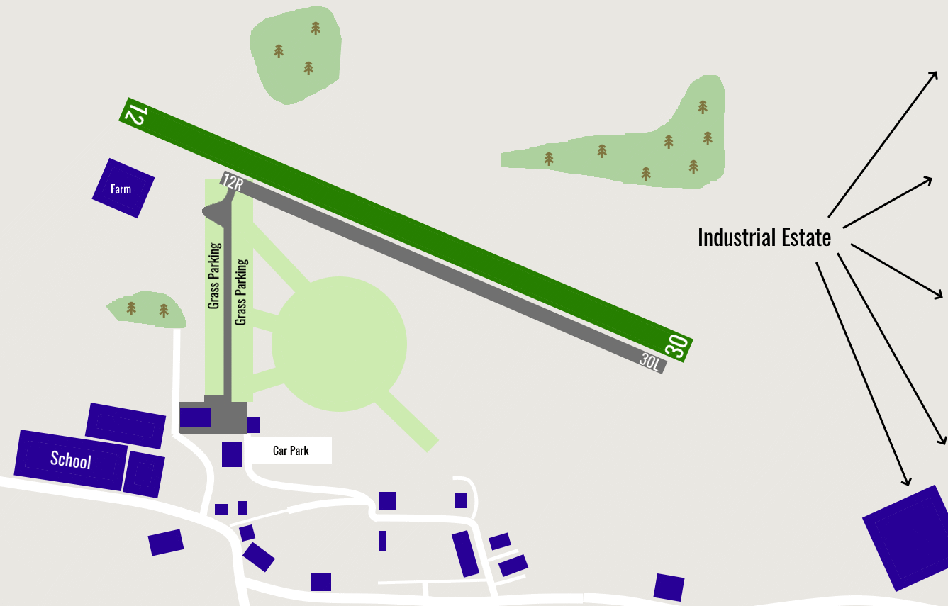
road Runways
Length: 640 m (2099.7376 ft) close_small 30 m (2099.7376 ft)
Surface: Grass
Headings: 294,114
| Runway | Surface | Length | Width | Lighting | TORA / LDA |
|---|---|---|---|---|---|
| 12 / 30 | Grass |
640 m 2099.7376 ft |
30 m 98.4252 ft |
Nil |
TORA: m (0ft) LDA: m (0ft) TORA: m (0ft) LDA: m (0ft) |
| 12R / 30L | Asphalt |
550 m 1804.462 ft |
7 m 22.96588 ft |
Nil |
TORA: m (0ft) LDA: m (0ft) TORA: m (0ft) LDA: m (0ft) |
altitude Elevation & Pressure
Altitude: 450 ft AMSL
QFE Available: Yes -- Estimated QFE: 1025 hPa
Transition Altitude: 3000 ft
description Airfield Notes
Unlicensed airfield used for Parachuting.


Parachuting takes place up to FL150.
loop Circuit & Procedures
Circuit Height 1000ft aal.

Rwy 12 - RH.

Rwy 30 - LH.
volume_off Noise Abatement
Avoid overflying the village of Shitton Colliery and Peterless below 3000ft.
link External Resources
image Images
Ground Layout: