METAR Info
METAR EGCK 270950Z 03008KT 9999 FEW002 15/09 Q1027
Category: VFR
Wind: 30° at 8 kt
Recomended Runway 03 based on current wind conditions, with a headwind component of 8 kt and a crosswind component of 0 kt.
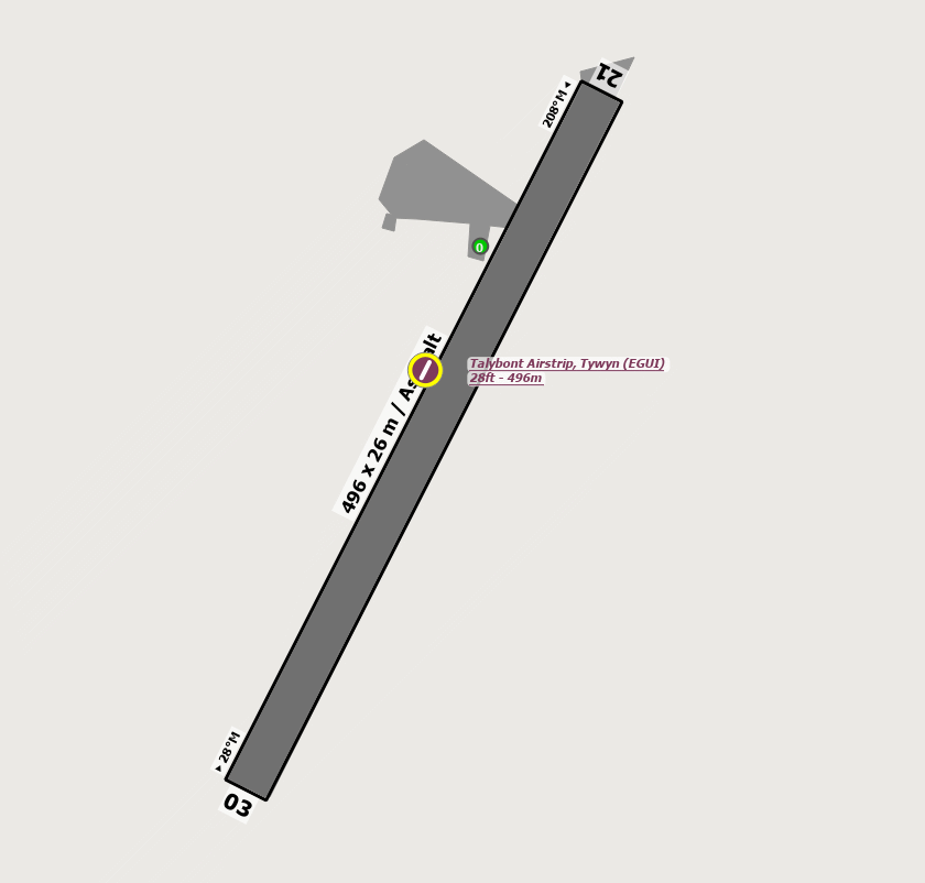
EGUI - Talybont
location_onLocation: 1 nm NE of Tywyn.
mapMap: Open in Maps
settings_input_antenna Comms
Unicom U 122.800
road Runways
Length: 496 m (1627.29664 ft) close_small 26 m (1627.29664 ft)
Surface: Grass
Headings: 208,28
| Runway | Surface | Length | Width | Lighting | TORA / LDA |
|---|---|---|---|---|---|
| 03 / 21 | Grass |
500 m 1640.42 ft |
16 m 52.49344 ft |
Nil |
TORA: m (0ft) LDA: m (0ft) TORA: m (0ft) LDA: m (0ft) |
altitude Elevation & Pressure
Altitude: 40 ft AMSL
QFE Available: Yes -- Estimated QFE: 1027 hPa
Transition Altitude: 3000 ft
description Airfield Notes
Presence of pedigree sheep all year round. PPR is required to ensure the runway is cleared.


The runway shall only remain clear up to one hour after the agreed ETA.
loop Circuit & Procedures
Rwy 03 - RH.

Rwy 21 - LH.
report_problem Warning
A/D suffers rotor in N & NW winds particularly Rwy 21.


Grass can be extremely slippery when wet so do not land long as Rwy gradient will not assist.


Local coastal winds.


The high ground to NE is up to 3000ft, and the arrival is uphill from both ends.


Slow-flying cormorants (Flocks up to 80 at a time).
link External Resources
image Images
Ground Layout: