METAR Info
METAR EGSS 270950Z AUTO 32003KT 240V010 9999 NCD 17/07 Q1025
Category: VFR
Wind: 320° at 3 kt
Recomended Runway 24 based on current wind conditions, with a headwind component of 0.5 kt and a crosswind component of 3 kt.
EGSR - Earls Colne
location_onLocation: 3 nm SE Halstead.
mapMap: Open in Maps
settings_input_antenna Comms
Earls colne Radio 122.430
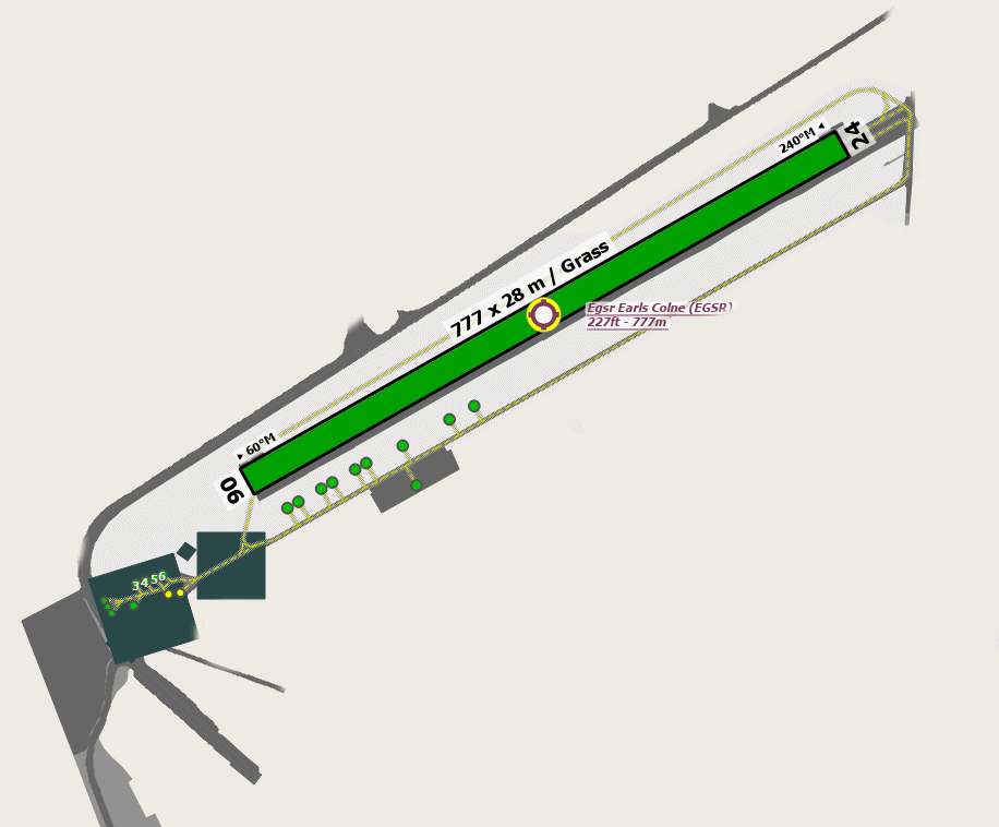
road Runways
Length: 777 m (2549.21268 ft) close_small 28 m (2549.21268 ft)
Surface: Grass
Headings: 240,60
| Runway | Surface | Length | Width | Lighting | TORA / LDA |
|---|---|---|---|---|---|
| 06 / 24 | Asphalt/Grass |
939 m 3080.70876 ft |
30 m 98.4252 ft |
Thr Rwy / Thr Rwy APAPI 3.5° |
TORA: 799 m (2621ft) LDA: 778 m (2552ft) TORA: 799 m (2621ft) LDA: 779 m (2556ft) |
altitude Elevation & Pressure
Altitude: 227 ft AMSL
QFE Available: Yes -- Estimated QFE: 1025 hPa
Transition Altitude: 6000 ft
radio Navaids
Name: CLN
Frequency: 114.6 kHz
Notes: R282 17.7
description Airfield Notes
Park as directed.
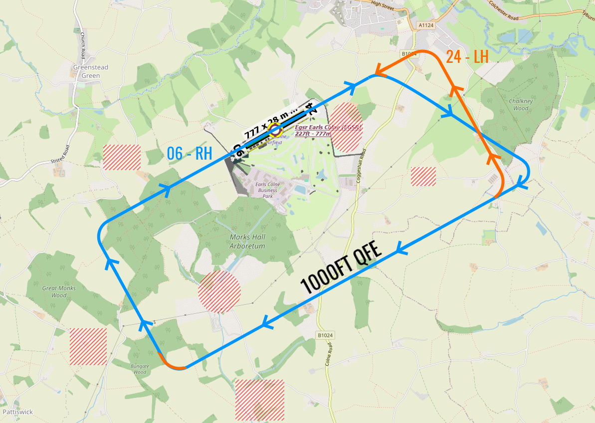
loop Circuit & Procedures
Circuit Height 1000ft agl QFE.

Rwy 06 - RH.

Rwy 24 - LH.
flight_takeoff Departure
Rwy 06 - Turn right abeam phone mast (located right of centre line) onto 120°M to avoid Earls Colne village.


No left turn-outs.


Rwy 24 - No right turn-outs below 1000ft agl.
volume_off Noise Abatement
Avoid overflying Earls Colne village.
report_problem Warning
Power cables 26ft aal cross final approach to Rwy 06 at 300m from thld.


Possible gliding activity at Wormingfor, 4nm ENE, winch launch up to 3000ft agl.


Helicopter circuits and approaches are different from fixed wing.
link External Resources
image Images
Ground Layout:
Circuit Diagram: