METAR Info
METAR EGSS 270950Z AUTO 32003KT 240V010 9999 NCD 17/07 Q1025
Category: VFR
Wind: 320° at 3 kt
Recomended Runway 27R based on current wind conditions, with a headwind component of 1.9 kt and a crosswind component of 2.3 kt.
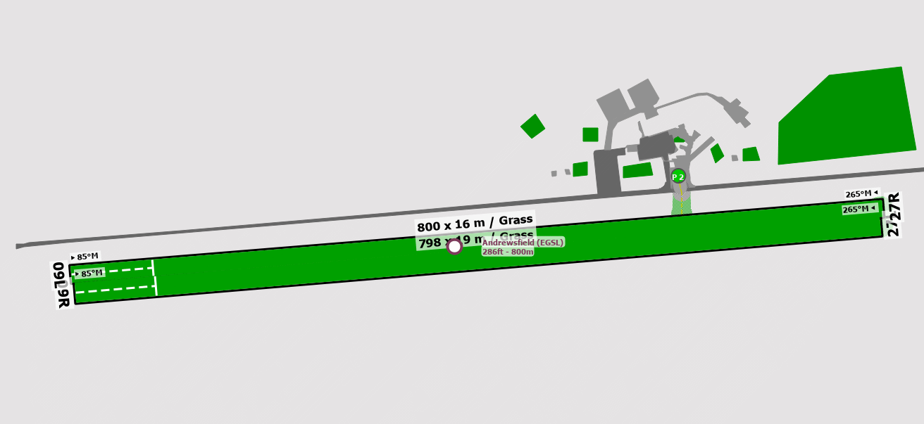
EGSL - Andrewsfield
location_onLocation: 4 nm WNW of Braintree.
mapMap: Open in Maps
settings_input_antenna Comms
Andrewsfield Radio 130.555
road Runways
Length: 800 m (2624.672 ft) close_small 16 m (2624.672 ft)
Surface: Grass
Headings: 265,85
| Runway | Surface | Length | Width | Lighting | TORA / LDA |
|---|---|---|---|---|---|
| 09L / 27R | Grass |
799 m 2621.39116 ft |
36 m 118.11024 ft |
Thr Rwy / Thr Rwy APAPI 3.5° LH |
TORA: 799 m (2621ft) LDA: 720 m (2362ft) TORA: 799 m (2621ft) LDA: 799 m (2621ft) |
| 09R / 27L | Grass |
799 m 2621.39116 ft |
36 m 118.11024 ft |
Thr Rwy / Ap Thr Rwy RCL PAPI 3.5° |
TORA: 799 m (2621ft) LDA: 720 m (2362ft) TORA: 799 m (2621ft) LDA: 799 m (2621ft) |
altitude Elevation & Pressure
Altitude: 286 ft AMSL
QFE Available: Yes -- Estimated QFE: 1025 hPa
Transition Altitude: 6000 ft
description Airfield Notes
Flights without reference to Stansted ATC may be made within the local flying area. (LFA) surface to 1500ft QNH within a 2nm radius from the centre of the aerodrome. Subject to VFR Minima.


Visiting aircraft are to park in the area adjacent to the windsock.
loop Circuit & Procedures
Circuit height 700ft aal.

All circuits RH.
volume_off Noise Abatement
Avoid overflying villages in the vicinity of the airfield.
link External Resources
image Images
Ground Layout: