METAR Info
METAR EGPF 270950Z AUTO 30009KT 9999 FEW033 14/08 Q1026
Category: VFR
Wind: 300° at 9 kt
Recomended Runway 25 based on current wind conditions, with a headwind component of 5.8 kt and a crosswind component of 6.9 kt.
EGPG - Cumbernauld
location_onLocation: 1.1 nm SW of Banknock.
mapMap: Open in Maps
settings_input_antenna Comms
Cumbernauld Radio 120.605
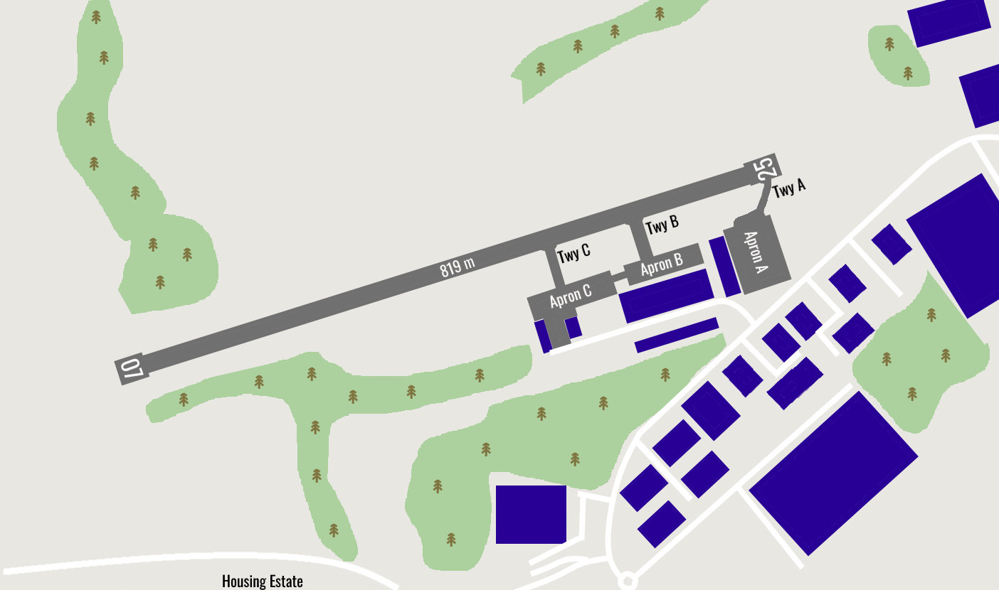
road Runways
Length: 819 m (2687.00796 ft) close_small 20 m (2687.00796 ft)
Surface: Asphalt
Headings: 254,74
| Runway | Surface | Length | Width | Lighting | TORA / LDA |
|---|---|---|---|---|---|
| 07 / 25 | Asphalt |
819 m 2687.00796 ft |
23 m 75.45932 ft |
Thr Rwy APAPI 4° / Thr Rwy APAPI 3.5° |
TORA: 819 m (2687ft) LDA: 819 m (2687ft) TORA: 819 m (2687ft) LDA: 819 m (2687ft) |
altitude Elevation & Pressure
Altitude: 348 ft AMSL
QFE Available: Yes -- Estimated QFE: 1026 hPa
Transition Altitude: 6000 ft
radio Navaids
Name: TLA
Frequency: 113.9 kHz
Notes: R325 35.5DME
description Airfield Notes
No aircraft is to start and carry out engine runs with there tail directed towards any hangars or other aircraft.
loop Circuit & Procedures
Circuit Height 800ft QFE.

Rwy 07 - LH.

Rwy 25 - RH.
volume_off Noise Abatement
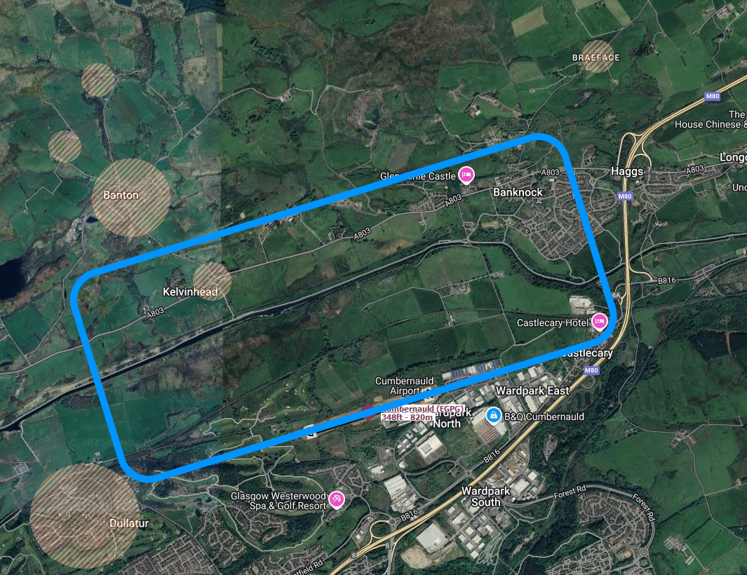
Avoid overflying village shown in the image.
report_problem Warning
High ground 1870ft amsl 5 nm and 1506ft amsl 4nm to the North West.
link External Resources
image Images
Ground Layout:
Circuit Diagram: