METAR Info
METAR EGNH 270950Z 29008KT 2000 VCFG BKN002 10/09 Q1027
Category: LIFR
Wind: 290° at 8 kt
Recomended Runway 28 based on current wind conditions, with a headwind component of 7.9 kt and a crosswind component of 1.4 kt.
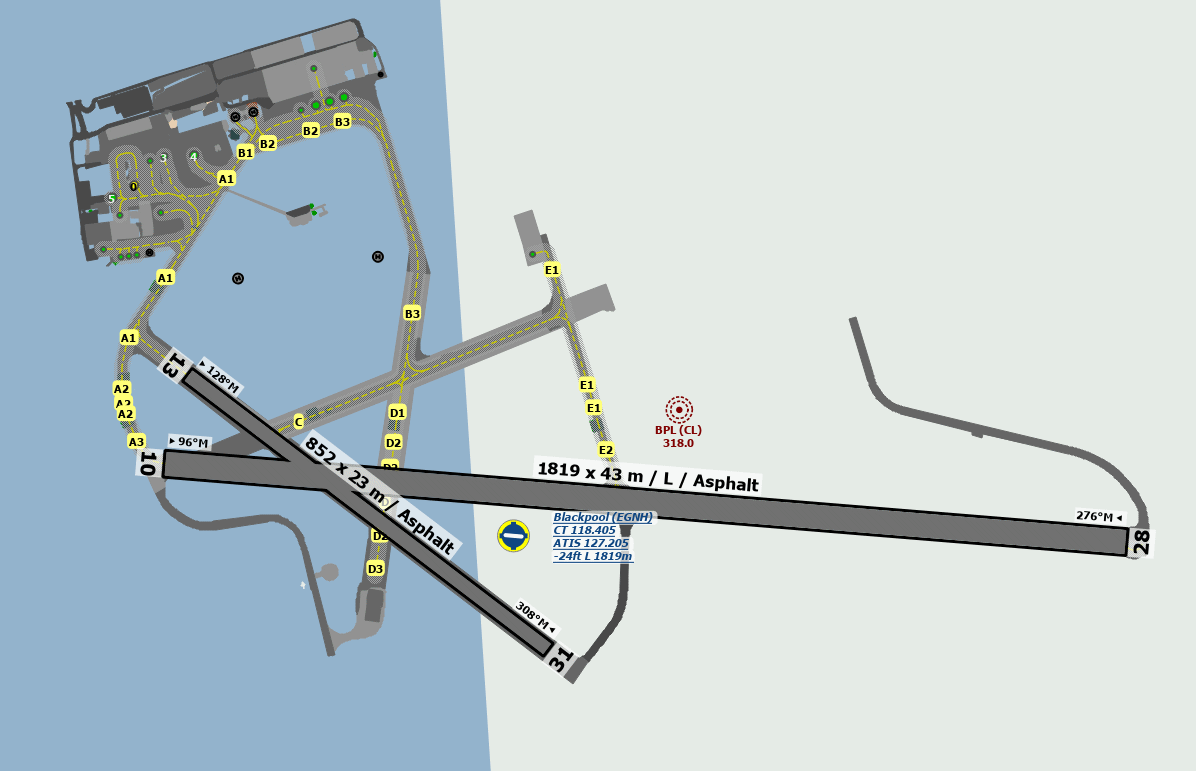
EGNH - Blackpool
location_onLocation: 2.8 nm SW of Blackpool
mapMap: Open in Maps
settings_input_antenna Comms
Blackpool T 120.0
A 119.955
Blackpool ATIS 127.
road Runways
Length: 1819 m (5967.84796 ft) close_small 43 m (5967.84796 ft)
Surface: Asphalt
Headings: 276,96
| Runway | Surface | Length | Width | Lighting | TORA / LDA |
|---|---|---|---|---|---|
| 10 / 28 | Asphalt |
1868 m 6128.60912 ft |
45 m 147.6378 ft |
Thr Rwy APAPI 3 ° |
TORA: 1868 m (6129ft) LDA: 1868 m (6129ft) TORA: 1868 m (6129ft) LDA: 1868 m (6129ft) |
| 13 / 31 | Asphalt |
998 m 3274.27832 ft |
24 m 78.74016 ft |
Nil |
TORA: 998 m (3274ft) LDA: 852 m (2795ft) TORA: 852 m (2795ft) LDA: 970 m (3182ft) |
altitude Elevation & Pressure
Altitude: 34 ft AMSL
QFE Available: Yes -- Estimated QFE: 1027 hPa
Transition Altitude: 3000 ft
radio Navaids
Name: POL
Frequency: 112.1 kHz
Notes: R274 33DME
description Airfield Notes
Rwy 13/31 daylight use only.

Parachuting is not permitted at Blackpool Aerodrome.

Visiting GA flights requiring fuel are requested to advise Blackpool ATC of this fact before landing.


Taxiing and parking on grass areas prohibited.
loop Circuit & Procedures
Circuit Height 1000ft QFE.

Rwy 10 - LH.

Rwy 13 - LH.

Rwy 28 - RH.

Rwy 31 - RH.
flight_takeoff Departure
During the notified hours of Warton Radar, VFR traffic departing Blackpool in a southerly direction should anticipate departure instructions to route via St Anne’s Pier, then Southport Pier, not above altitude 1,500 FT AMSL until clear of Warton MATZ.
report_problem Warning
Damage to the grass areas to the edge of paved surfaces caused by rabbits.

Birds Sept to April.
link External Resources
image Images
Ground Layout: