METAR Info
METAR EGQA 270950Z 29011KT 9999 -RA FEW020TCU BKN050 12/08 Q1025 RMK BLU
Category: VFR
Wind: 290° at 11 kt
Recomended Runway 28 based on current wind conditions, with a headwind component of 10.8 kt and a crosswind component of 1.9 kt.
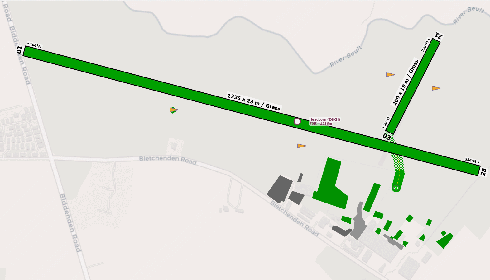
EGKH - Headcorn
location_onLocation: 1 nm SW of Headcorn
mapMap: Open in Maps
settings_input_antenna Comms
Headcorn Radio 122.210
road Runways
Length: 1236 m (4055.11824 ft) close_small 23 m (4055.11824 ft)
Surface: Grass
Headings: 284,104
| Runway | Surface | Length | Width | Lighting | TORA / LDA |
|---|---|---|---|---|---|
| 10 / 28 | Grass |
1250 m 4101.05 ft |
30 m 98.4252 ft |
Portable electric / - PNR |
TORA: 1150 m (3773ft) LDA: 1000 m (3281ft) TORA: 1100 m (3609ft) LDA: 1000 m (3281ft) |
| 03 / 21 | Grass |
269 m 882.54596 ft |
30 m 98.4252 ft |
Nil |
TORA: m (0ft) LDA: m (0ft) TORA: m (0ft) LDA: m (0ft) |
altitude Elevation & Pressure
Altitude: 72 ft AMSL
QFE Available: Yes -- Estimated QFE: 1025 hPa
Transition Altitude: 3000 ft
radio Navaids
Name: DET
Frequency: 117.3 kHz
Notes: R168 9DME
description Airfield Notes
Aerodrome licences for night use, free fall parachuting from up to FL150. Parachute DZ 300m NW of runway 28 thld.


While parachuting is in progress, there are no overhead joins, and all aircraft join downwind.

Rotary wing aircraft are to obtain clearance prior to engaging rotors.


All aircraft are to contact Headcorn Radio before taxi.
loop Circuit & Procedures
Rwy - 10 LH 1000ft aal, rotary LH 700ft aal.

Rwy - 28 RH 1000ft aal.
flight_takeoff Departure
Aircraft departing 10/28 are to climb to 500ft QFE before turning keeping clear of built-up areas.
volume_off Noise Abatement
All aircraft are to avoid local villages.
warning Caution
Taxi with care due to undulating ground in some parts of the taxiway.
report_problem Warning
Hill at 522ft amsl, 013.5T, 3.7nm from the airport.
link External Resources
image Images
Ground Layout: