METAR Info
METAR EGJB 270950Z 05011KT 9999 FEW012 14/11 Q1023
Category: VFR
Wind: 50° at 11 kt
Recomended Runway 09 based on current wind conditions, with a headwind component of 8.4 kt and a crosswind component of 7.1 kt.
EGJB - Guernsey
location_onLocation: 2.5 NM WSW of St Peter Port
mapMap: Open in Maps
settings_input_antenna Comms
Guernsey ground Ground 121.805
Guernsey tower Tower 119.955
Guernsey radar Approach 124.505
road Runways
Length: 1583 m (5193.56972 ft) close_small 45 m (5193.56972 ft)
Surface: Asphalt
Headings: 268,88
| Runway | Surface | Length | Width | Lighting | TORA / LDA |
|---|---|---|---|---|---|
| 09 / 27 | Asphalt |
1583 m 5193.56972 ft |
45 m 147.6378 ft |
Ap Thr Rwy RCL PAPI 3° |
TORA: 1463 m (4800ft) LDA: 1463 m (4800ft) TORA: 1583 m (5194ft) LDA: 1463 m (4800ft) |
altitude Elevation & Pressure
Altitude: 336 ft AMSL
QFE Available: Yes -- Estimated QFE: 1023 hPa
Transition Altitude: 5000 ft
radio Navaids
Name: GUR
Frequency: 109.4 kHz
loop Circuit & Procedures
Standard circuit height is 700 FT AAL


VFR clearance to operate within the Guernsey ATZ will not be granted if the reported visibility is less than 5 KM or the reported cloud ceiling is less than 1500 FT in accordance with SERA.5001.
flight_takeoff Departure
Non-SID IFR, VFR or Special VFR departures weighing less than 5,700 kg must climb straight ahead until at least 850 FT AMSL before turning. This also applies to circuit traffic.
warning Caution
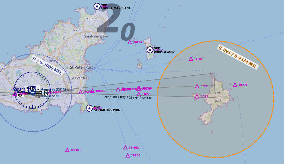
Sark Restricted Area


Pilots are to note that flight is not permitted at a height of less than 2000 FT above ground level within 3 NM of 492546N 0022145W on the Island of Sark (R095) except with the permission of the Channel Islands Director of Civil Aviation or from Guernsey ATC as necessary.
link External Resources
image Images
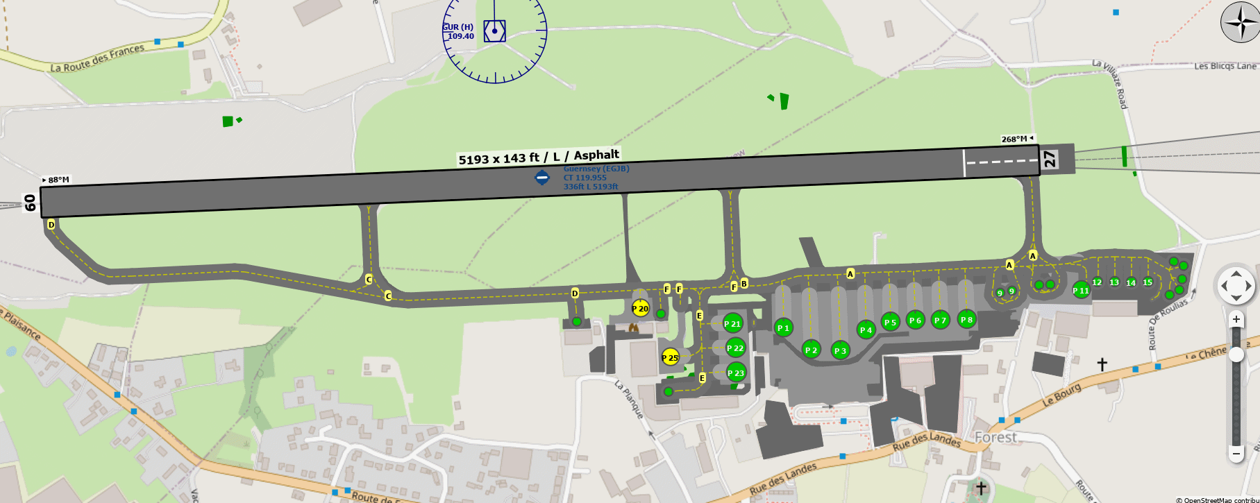
Ground Layout:
Circuit Diagram: