METAR Info
METAR EGPH 270950Z 34004KT 270V040 9999 FEW045 14/08 Q1026
Category: VFR
Wind: 340° at 4 kt
Recomended Runway 28 based on current wind conditions, with a headwind component of 2 kt and a crosswind component of 3.5 kt.
EGIT - Nether Huntlywood
location_onLocation: 1.5 nm W of Gordon.
mapMap: Open in Maps
settings_input_antenna Comms
Unicom U 122.800
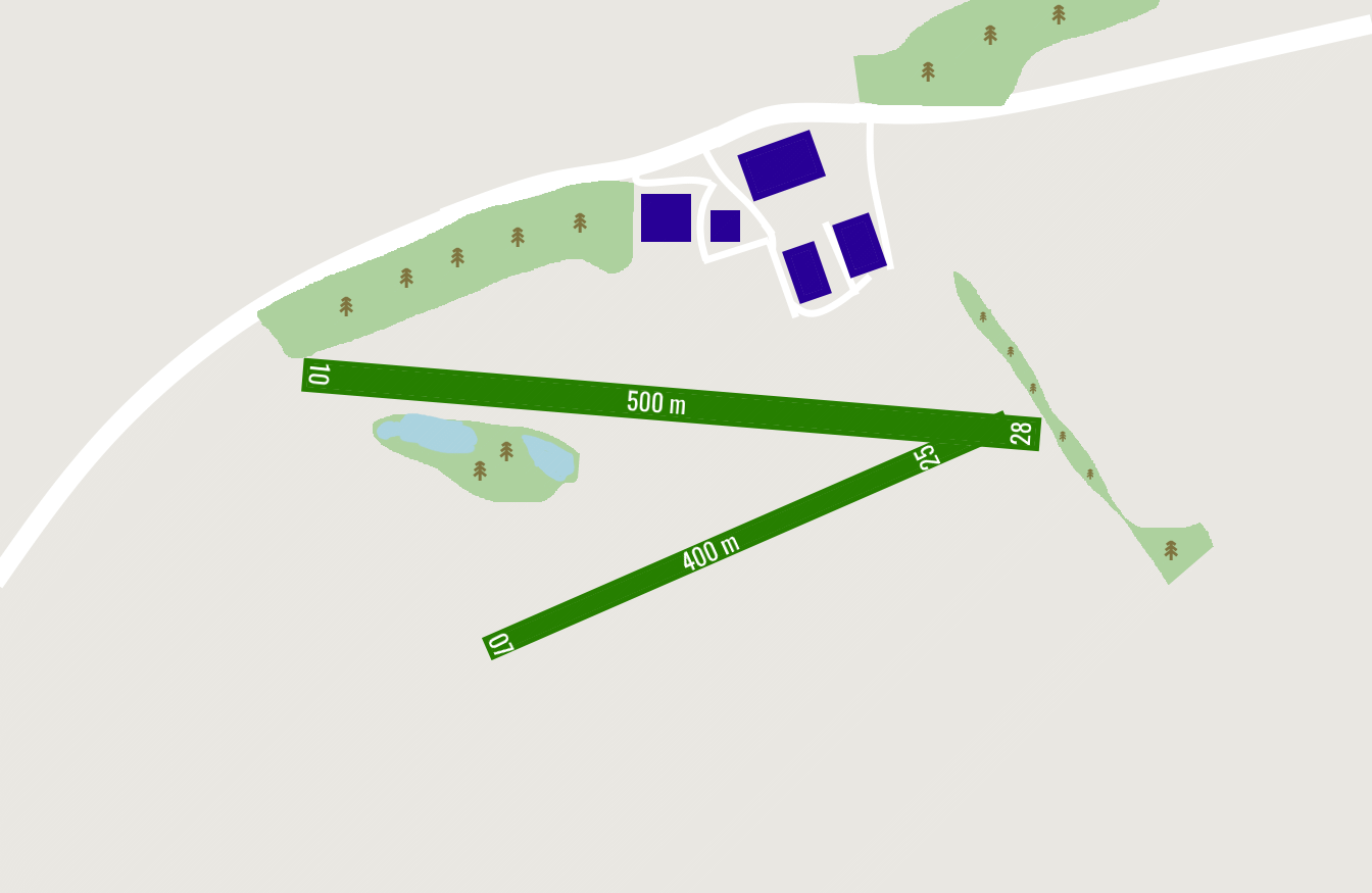
road Runways
Length: 500 m (1640.42 ft) close_small 25 m (1640.42 ft)
Surface: Grass
Headings: 276,96
| Runway | Surface | Length | Width | Lighting | TORA / LDA |
|---|---|---|---|---|---|
| 07 / 25 | Grass |
500 m 1640.42 ft |
25 m 82.021 ft |
Nil |
TORA: m (0ft) LDA: m (0ft) TORA: m (0ft) LDA: m (0ft) |
| 10 / 28 | Grass |
400 m 1312.336 ft |
25 m 82.021 ft |
Nil |
TORA: m (0ft) LDA: m (0ft) TORA: m (0ft) LDA: m (0ft) |
altitude Elevation & Pressure
Altitude: 550 ft AMSL
QFE Available: Yes -- Estimated QFE: 1026 hPa
Transition Altitude: 3000 ft
radio Navaids
Name: SAB
Frequency: 112.5 kHz
Notes: R224 19.3DME
description Airfield Notes
PPR is essential as sheep graze the airfield, low level fly past is advisable to check runway status.
report_problem Warning
No landing on Rwy 10.

Twy 07/25 has undulations, Rwy 28 has an upslope.

Powerlines 1nm West of the airfield.
link External Resources
image Images
Ground Layout: