METAR Info
METAR EGHI 271020Z 06007KT 030V100 CAVOK 18/04 Q1024
Category: VFR
Wind: 60° at 7 kt
Recomended Runway 05 based on current wind conditions, with a headwind component of 6.9 kt and a crosswind component of 1.2 kt.
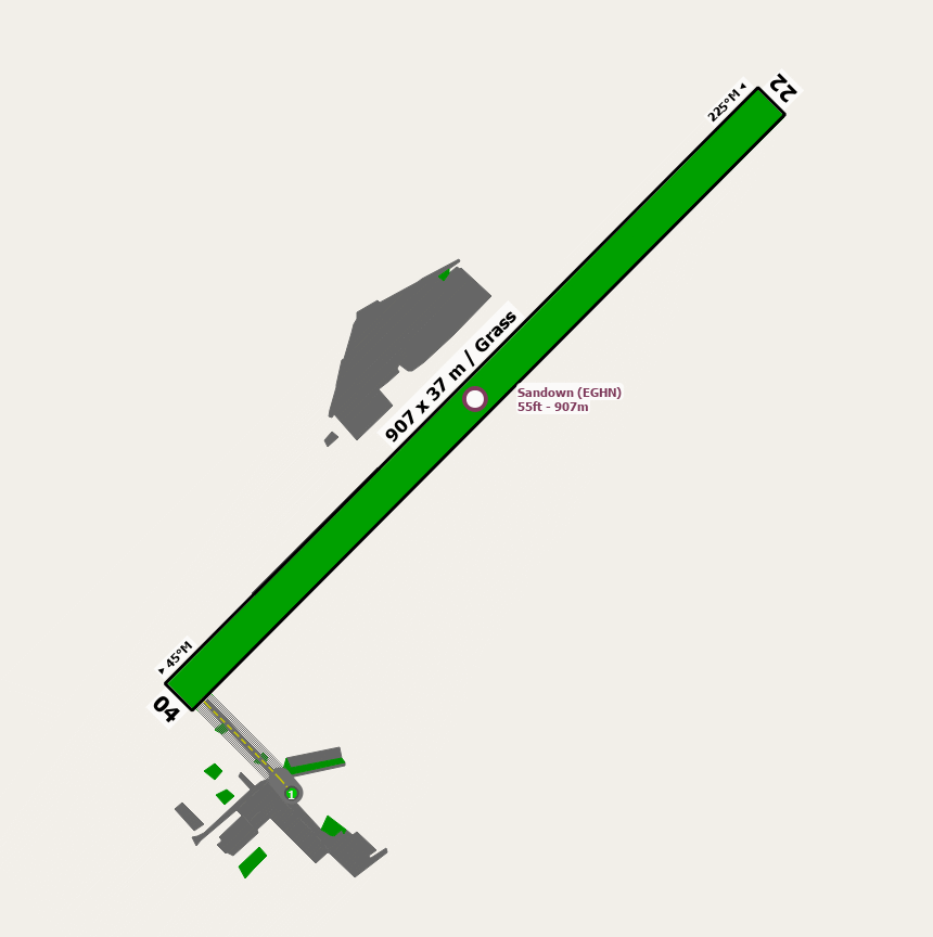
EGHN - Sandown
location_onLocation: 1nm W of Sandown.
mapMap: Open in Maps
settings_input_antenna Comms
Sandown Radio 119.280
road Runways
Length: 907 m (2975.72188 ft) close_small 37 m (2975.72188 ft)
Surface: Grass
Headings: 225,45
| Runway | Surface | Length | Width | Lighting | TORA / LDA |
|---|---|---|---|---|---|
| 05 / 23 | Grass |
884 m 2900.26256 ft |
40 m 131.2336 ft |
Nil |
TORA: 884 m (2900ft) LDA: 775 m (2543ft) TORA: 884 m (2900ft) LDA: 884 m (2900ft) |
altitude Elevation & Pressure
Altitude: 55 ft AMSL
QFE Available: Yes -- Estimated QFE: 1024 hPa
Transition Altitude: 3000 ft
radio Navaids
Name: GWC
Frequency: 114.8 kHz
Notes: R233 20DME
loop Circuit & Procedures
Circuit Height 1000ft QFE.

Rwy 05 - LH.

Rwy 23 - RH.


Noise Abatement:

Departing traffic runway 05 or 23 straight ahead for 1nm before turning.
warning Caution
Public footpath crossed runway 300m from Rwy 05 threshold.

Rising ground and trees to SW and NE.
link External Resources
image Images
Ground Layout: