METAR Info
METAR EGHI 271020Z 06007KT 030V100 CAVOK 18/04 Q1024
Category: VFR
Wind: 60° at 7 kt
Recomended Runway 12 based on current wind conditions, with a headwind component of 3.5 kt and a crosswind component of 6.1 kt.
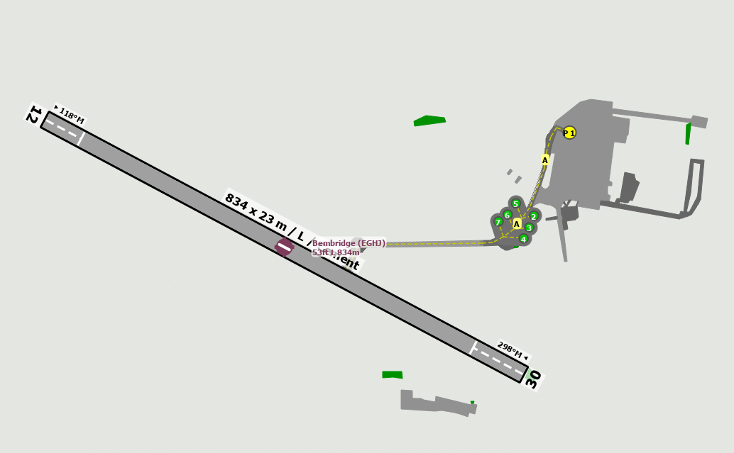
EGHJ - Bembridge
location_onLocation: 2.3 nm NW Sandown.
mapMap: Open in Maps
settings_input_antenna Comms
Bembridge Radio 123.255
road Runways
Length: 832 m (2729.65888 ft) close_small 23 m (2729.65888 ft)
Surface: Cement
Headings: 298,118
| Runway | Surface | Length | Width | Lighting | TORA / LDA |
|---|---|---|---|---|---|
| 12 / 30 | Concrete |
827 m 2713.25468 ft |
23 m 75.45932 ft |
Nil |
TORA: 799 m (2621ft) LDA: 775 m (2543ft) TORA: 799 m (2621ft) LDA: 751 m (2464ft) |
altitude Elevation & Pressure
Altitude: 53 ft AMSL
QFE Available: Yes -- Estimated QFE: 1024 hPa
Transition Altitude: 3000 ft
description Airfield Notes
Operated by B.A.L.

Non-radio aircraft not accepted.

Park only in designated areas north of the concrete runway.
loop Circuit & Procedures
Circuits 1000ft QFE.

Rwy 12 - LH.

Rwy 30 - RH.
volume_off Noise Abatement
Do not overly village.
report_problem Warning
High ground 345ft aal, 400ft amsl 270°/2 nm.

Trees and rising ground within the approach sector to Rwy 30.


Severe turbulence can be encountered on approach in wind speeds above 25 Kts from 090° through south to 230° and tailwinds at both ends of the runways in southernly winds. Possible wind shear in strong winds.
link External Resources
image Images
Ground Layout: