METAR Info
METAR EGHI 270950Z 06006KT 350V110 CAVOK 18/04 Q1024
Category: VFR
Wind: 60° at 6 kt
Recomended Runway 05 based on current wind conditions, with a headwind component of 5.9 kt and a crosswind component of 1 kt.
EGHF - Lee on Solent
location_onLocation: 4 nm SW of Fareham
mapMap: Open in Maps
settings_input_antenna Comms
Lee Information 118.930
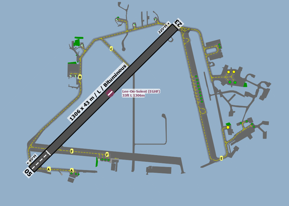
road Runways
Length: 1306 m (4284.77704 ft) close_small 43 m (4284.77704 ft)
Surface: Bituminous
Headings: 225,45
| Runway | Surface | Length | Width | Lighting | TORA / LDA |
|---|---|---|---|---|---|
| 05 / 23 | Asphalt |
1029 m 3375.98436 ft |
30 m 98.4252 ft |
Nil |
TORA: 1179 m (3868ft) LDA: 1026 m (3366ft) TORA: 1026 m (3366ft) LDA: 1026 m (3366ft) |
altitude Elevation & Pressure
Altitude: 32 ft AMSL
QFE Available: Yes -- Estimated QFE: 1024 hPa
Transition Altitude: 3000 ft
description Airfield Notes
Pilots approaching Lee-on-Solent and intending to remain outside of Southampton CTR/Solent CTA are advised to maintain a listening watch only on Solent Radar 120.230 MHz and select SSR code 7011 to reduce the risk of infringing adjacent controlled airspace.

Fleetlands ATZ is to be avoided unless two-way contact is made on 135.700 MHz.

The Coastguard apron, helipad and dispersal is out of bounds and is not to be used by visiting aircraft.


All fixed wing aircraft should be aware of rotary traffic operating to the south of the main runway.

The Runways 05/23 and grass strip are operated as a single runway strip. No simultaneous parallel approaches or departures are permitted.
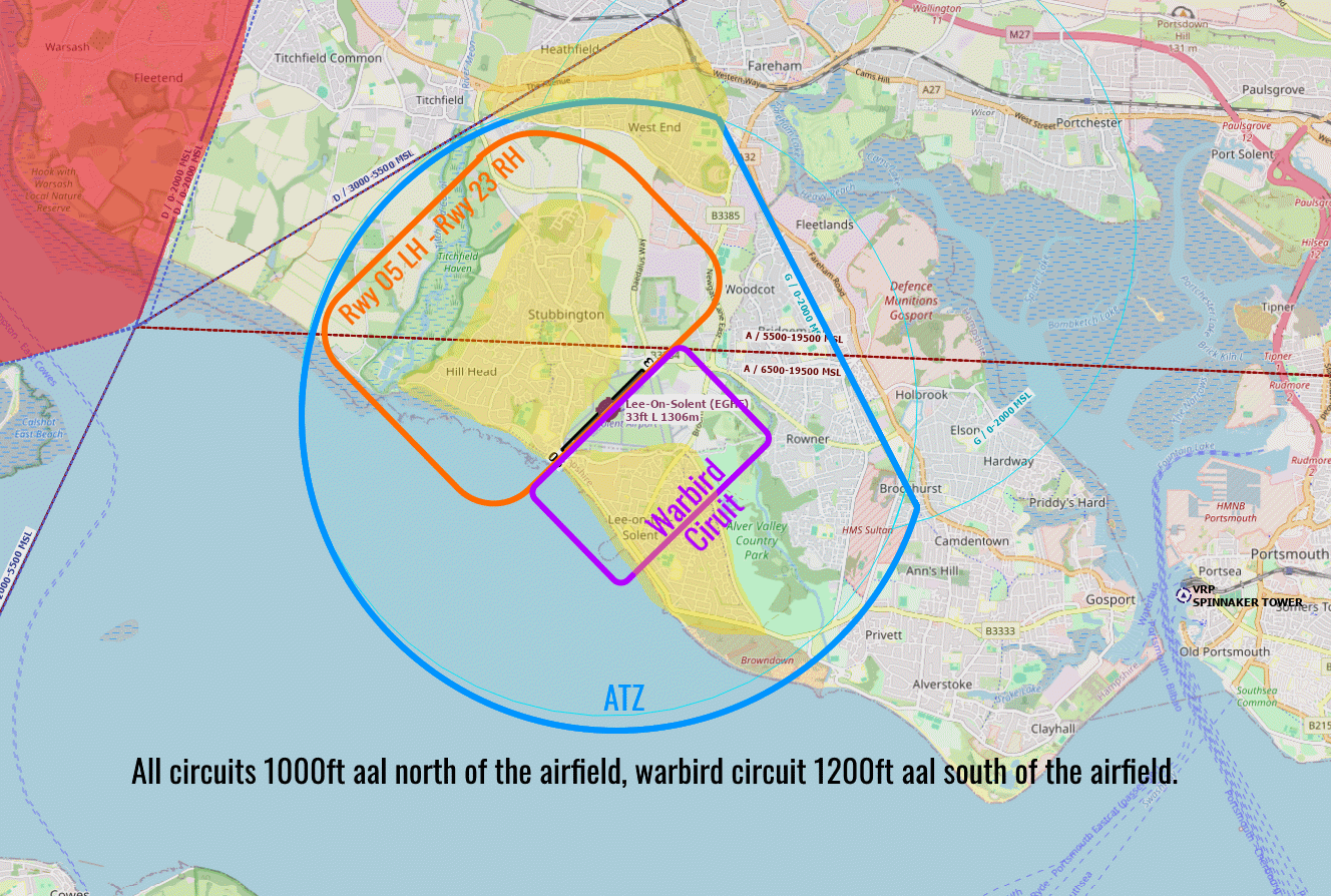
loop Circuit & Procedures
Circuits at 1000 FT AAL -

Rwy 05 - LH.

Rwy 23 - RH.

Warbird circuit at 1200 FT AAL

Rwy 05 - RH.

Rwy 23 - LH.
flight_land Arrival
Aircraft arriving from the north are suggested to join via either West Meon crossroads VRP or Wickham VRP. For noise abatement after Wickham VRP, head for the Titchfield Gyratory maintaining clear of built up areas. Aircraft arriving from the south, west and east are suggested to join via Spinnaker VRP, Calshot VRP or Cowes VRP. Be aware that Calshot VRP is located underneath Solent CTA 2 which extends from 2000ft – 5500ft AMSL and is just to south of the Southampton Airport CTZ.
flight_takeoff Departure
Runway 05 - remain to the west of the disused railway line or to the south of the solar farm to avoid Fleetlands ATZ. Straight out departures are to be arranged prior to take-off with Fleetlands Information on 135.700 MHz.
report_problem Warning
Solent CTA approximately 3 NM west of aerodrome.

SAR and rotary daily H24 operations.

Model Aircraft Flying operates in the south-east of the aerodrome.

Fleetlands Heliport is located 1.9 NM to the north-east of Lee-on-Solent and has an active ATZ.

Possible Compass Error when using Runway 05 Bravo 2 Hold. Some aircraft may experience magnetic disturbances, affecting the Heading Reference System. Pilots should ensure that, pre-flight checks are conducted within the white box or at the hold point. When positioned for take-off from Runway 05 the aircraft heading reference is checked against the runway alignment. Aircrew noticing a compass anomaly should notify ATC as soon as possible.
link External Resources
image Images
Ground Layout:
Circuit Diagram: