METAR Info
METAR EGPH 270950Z 34004KT 270V040 9999 FEW045 14/08 Q1026
Category: VFR
Wind: 340° at 4 kt
Recomended Runway 07 based on current wind conditions, with a headwind component of -0 kt and a crosswind component of 4 kt.
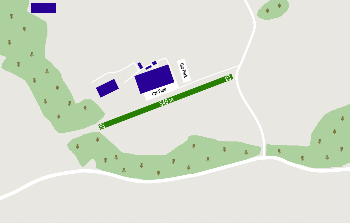
EGGU - Archerfield
location_onLocation: 0.7 nm W of Dileton
mapMap: Open in Maps
settings_input_antenna Comms
Unicom U 122.800
road Runways
Length: 549 m (1801.18116 ft) close_small 14 m (1801.18116 ft)
Surface: Grass
Headings: 250,070
| Runway | Surface | Length | Width | Lighting | TORA / LDA |
|---|---|---|---|---|---|
| 07 / 25 | Grass |
549 m 1801.18116 ft |
14 m 45.93176 ft |
Nil |
TORA: m (0ft) LDA: m (0ft) TORA: m (0ft) LDA: m (0ft) |
altitude Elevation & Pressure
Altitude: 100 ft AMSL
QFE Available: Yes -- Estimated QFE: 1026 hPa
Transition Altitude: 3000 ft
radio Navaids
Name: SAB
Frequency: 112.5 kHz
Notes: R293 22DME
description Airfield Notes
Private Airstrip.
warning Caution
Public road running just before Rwy 25 Threshold.
link External Resources
image Images
Ground Layout: