METAR Info
METAR EGPH 271020Z 35004KT 250V050 9999 SCT045 15/06 Q1026
Category: VFR
Wind: 350° at 4 kt
Recomended Runway 07 based on current wind conditions, with a headwind component of 0.7 kt and a crosswind component of 3.9 kt.
EGFQ - Charterhall
location_onLocation: 5.3 nm NW of Coldstream.
mapMap: Open in Maps
settings_input_antenna Comms
Unicom U 122.800
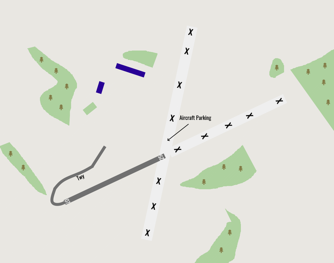
road Runways
Length: 7 m (22.96588 ft) close_small 25 m (22.96588 ft)
Surface: Asphalt
Headings: 250,070
| Runway | Surface | Length | Width | Lighting | TORA / LDA |
|---|---|---|---|---|---|
| 07 / 25 | Asphalt |
600 m 1968.504 ft |
12 m 39.37008 ft |
Nil |
TORA: m (0ft) LDA: m (0ft) TORA: m (0ft) LDA: m (0ft) |
altitude Elevation & Pressure
Altitude: 350 ft AMSL
QFE Available: Yes -- Estimated QFE: 1026 hPa
Transition Altitude: 3000 ft
description Airfield Notes
Fight sim may show runways 01-19 this is not in use.
loop Circuit & Procedures
Circuit Height 1000ft aal.

Rwy 07 - RH.

Rwy 25 - LH.
report_problem Warning
The airfield is used for farming and MoD training.
link External Resources
image Images
Ground Layout: