METAR Info
METAR EGNT 270950Z 34008KT 9999 FEW026 15/09 Q1025
Category: VFR
Wind: 340° at 8 kt
Recomended Runway 01 based on current wind conditions, with a headwind component of 6.9 kt and a crosswind component of 4 kt.
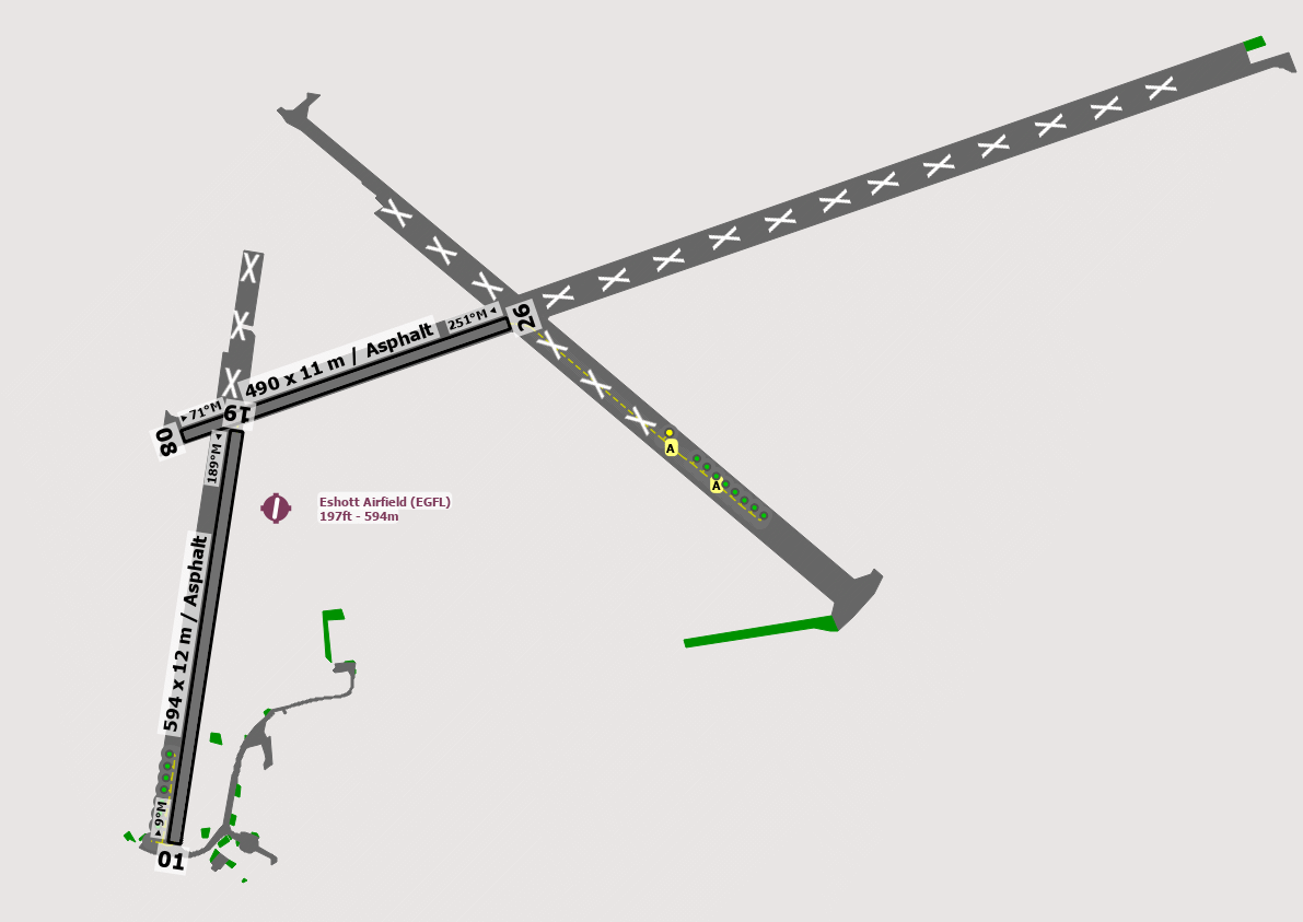
EGFL - Eshott
location_onLocation: 14.4 nm N or Newcastle Airport
mapMap: Open in Maps
settings_input_antenna Comms
Eshott Radio 122.855
road Runways
Length: 594 m (1948.81896 ft) close_small 12 m (1948.81896 ft)
Surface: Asphalt
Headings: 189,9
| Runway | Surface | Length | Width | Lighting | TORA / LDA |
|---|---|---|---|---|---|
| 01 / 19 | Asphalt |
610 m 2001.3124 ft |
12 m 39.37008 ft |
Nil |
TORA: m (0ft) LDA: m (0ft) TORA: m (0ft) LDA: m (0ft) |
| 01 / 19 | Grass |
550 m 1804.462 ft |
12 m 39.37008 ft |
Nil |
TORA: m (0ft) LDA: m (0ft) TORA: m (0ft) LDA: m (0ft) |
| 08 / 26 | Asphalt |
500 m 1640.42 ft |
12 m 39.37008 ft |
Nil |
TORA: m (0ft) LDA: m (0ft) TORA: m (0ft) LDA: m (0ft) |
altitude Elevation & Pressure
Altitude: 197 ft AMSL
QFE Available: Yes -- Estimated QFE: 1025 hPa
Transition Altitude: 3000 ft
radio Navaids
Name: SAB
Frequency: 112.5 kHz
Notes: R165 41DME
description Airfield Notes
Unlicenced airfield.

Intense activity in the area.<BR><BR>Rwy 19 - RH is generally preferred due to its length and to allow you a choice of Tarmac or Grass. This also allows for circuits away from noise-sensitive areas.
loop Circuit & Procedures
Circuit Height 1000ft QFE.

Rwy 01 - LH.

Rwy 08 - RH.

Rwy 19 - RH.

Rwy 26 - LH.
volume_off Noise Abatement
Avoid overflying Felton Village to the North and the habitation in the immediate vicinity of the airfield.
link External Resources
image Images
Ground Layout: