METAR Info
METAR EGNV 271020Z 01006KT 340V050 9999 SCT029 14/07 Q1025
Category: VFR
Wind: 10° at 6 kt
Recomended Runway 08 based on current wind conditions, with a headwind component of 2.1 kt and a crosswind component of 5.6 kt.
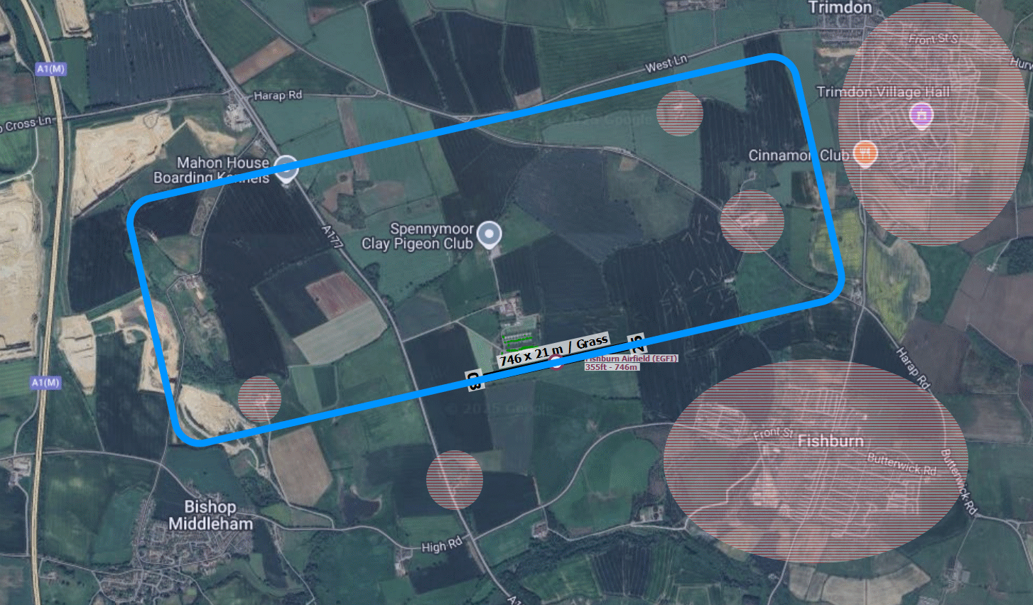
EGFI - Fishburn
location_onLocation: 08 nm WWN of Fishburn.
mapMap: Open in Maps
settings_input_antenna Comms
Fishburn Radio 118.280
road Runways
Length: 745 m (2444.2258 ft) close_small 21 m (2444.2258 ft)
Surface: Grass
Headings: 258,78
| Runway | Surface | Length | Width | Lighting | TORA / LDA |
|---|---|---|---|---|---|
| 08 / 26 | Grass |
790 m 2591.8636 ft |
30 m 98.4252 ft |
Nil |
TORA: m (0ft) LDA: m (0ft) TORA: m (0ft) LDA: m (0ft) |
altitude Elevation & Pressure
Altitude: 377 ft AMSL
QFE Available: Yes -- Estimated QFE: 1025 hPa
Transition Altitude: 3000 ft
description Airfield Notes
Airfield situated 3nm from the NNW boundry of Teeside airports CTR.
loop Circuit & Procedures
Circuit Height 1000ft aal.

Rwy 08 - LH.

Rwy 26 - RH.
volume_off Noise Abatement
Avoid overflying the villages of Trimdon, Fishburn and Bishop Middleham.
report_problem Warning
The runway has several distinct gradients.

High tension cables run across the approach to runway 26 approximately 2 miles out.
link External Resources
image Images
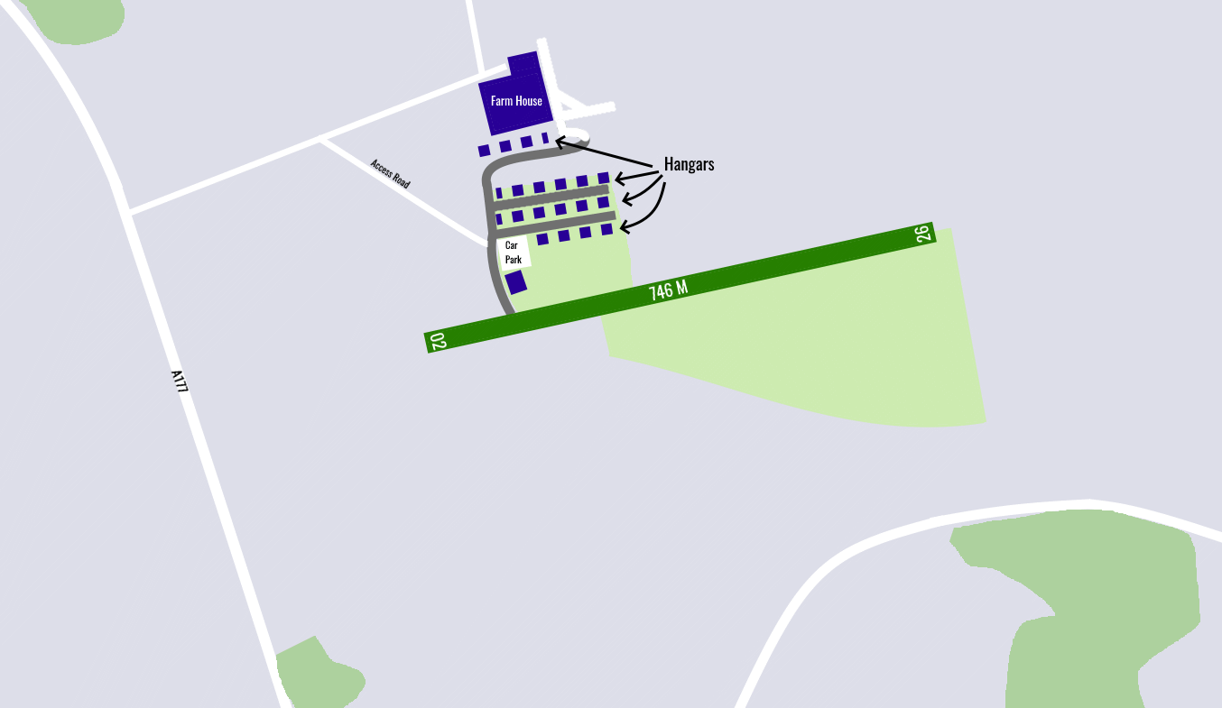
Ground Layout:
Circuit Diagram: