METAR Info
METAR EGSY 270950Z 19004KT CAVOK 16/08 Q1025
Category: VFR
Wind: 190° at 4 kt
Recomended Runway 21 based on current wind conditions, with a headwind component of 3.8 kt and a crosswind component of 1.4 kt.
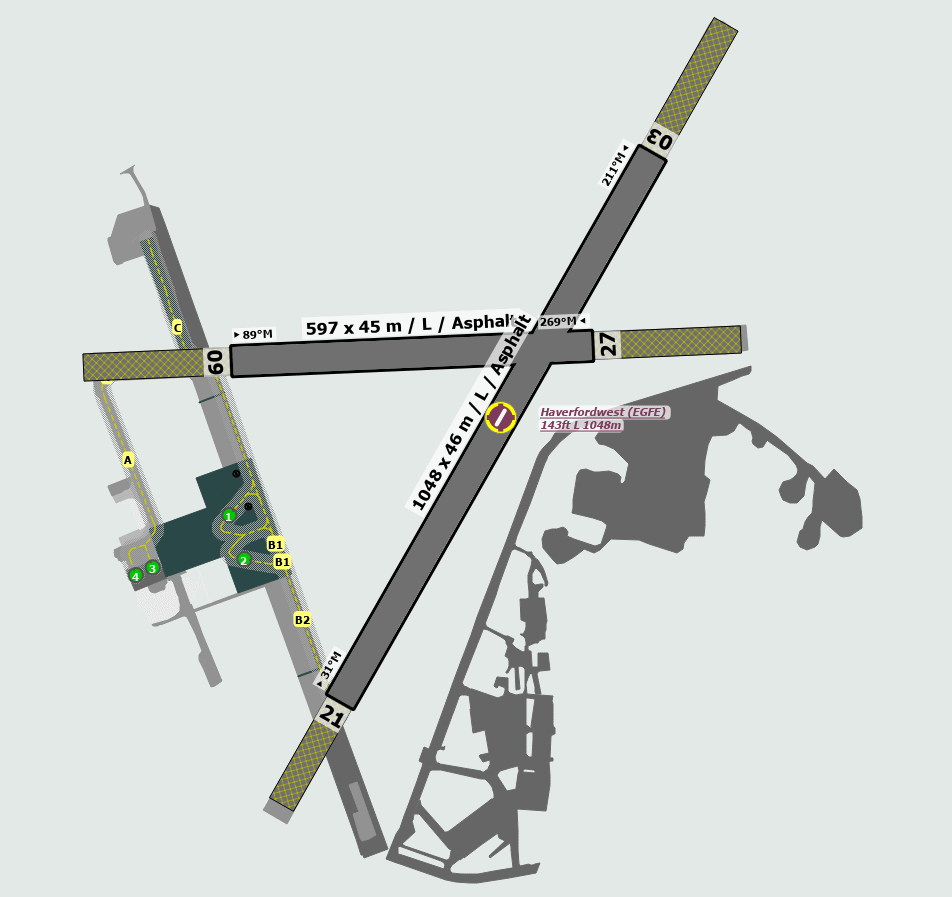
EGFE - Haverfordwest
location_onLocation: 2 nm N of Haverfordwest.
mapMap: Open in Maps
settings_input_antenna Comms
Haverfordwest Radio 123.605
road Runways
Length: 1048 m (3438.32032 ft) close_small 46 m (3438.32032 ft)
Surface: Asphalt
Headings: 211,31
| Runway | Surface | Length | Width | Lighting | TORA / LDA |
|---|---|---|---|---|---|
| 03 / 21 | Asphalt |
1486 m 4875.32824 ft |
45 m 147.6378 ft |
Thr Rwy APAPI 3.5° |
TORA: 1199 m (3934ft) LDA: 1202 m (3944ft) TORA: 1199 m (3934ft) LDA: 1267 m (4157ft) |
| 09 / 27 | Asphalt |
1035 m 3395.6694 ft |
45 m 147.6378 ft |
Nil |
TORA: 828 m (2717ft) LDA: 798 m (2618ft) TORA: 798 m (2618ft) LDA: 798 m (2618ft) |
altitude Elevation & Pressure
Altitude: 163 ft AMSL
QFE Available: Yes -- Estimated QFE: 1025 hPa
Transition Altitude: 3000 ft
radio Navaids
Name: STU
Frequency: 113.1 kHz
Notes: R165 10DME
description Airfield Notes
The grass areas are unsuitable for aircraft movement.
loop Circuit & Procedures
Circuit Height 1000ft QFE.

All Circuits LH.
volume_off Noise Abatement
Avoid overflying the local Riding Stables to north Rwy 09/27.
report_problem Warning
TV Mast 965ft aal 1120ft amsl 042°/4.8nm.

Hill rising to 259ft amsl with 2 nm to East, rising to 276ft amsl within 1.5 nm to the NE and rising to 583ft amsl within 3.5 nm to the N.
link External Resources
image Images
Ground Layout: