METAR Info
METAR EGOS 270950Z 32008KT 9000 HZ FEW012 12/09 Q1026 NOSIG RMK BLU BLU
Category: VFR
Wind: 320° at 8 kt
Recomended Runway 04 based on current wind conditions, with a headwind component of 1.4 kt and a crosswind component of 7.9 kt.
EGCW - Welshpool
location_onLocation: 2 nm S of Welshpool
mapMap: Open in Maps
settings_input_antenna Comms
Welshpool Radio 128.005
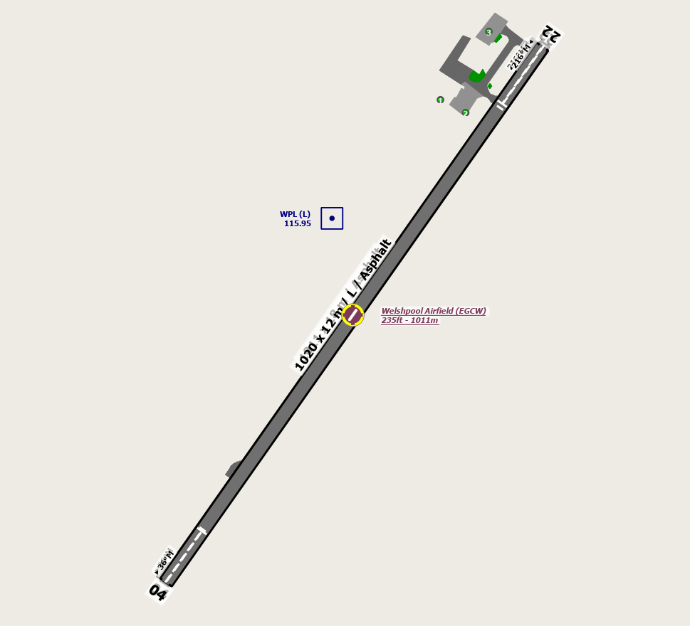
road Runways
Length: 1011 m (3316.92924 ft) close_small 18 m (3316.92924 ft)
Surface: Asphalt
Headings: 212,36
| Runway | Surface | Length | Width | Lighting | TORA / LDA |
|---|---|---|---|---|---|
| 04 / 22 | Asphalt |
1028 m 3372.70352 ft |
18 m 59.05512 ft |
Rwy APAPI 3° |
TORA: 799 m (2621ft) LDA: 902 m (2959ft) TORA: 799 m (2621ft) LDA: 879 m (2884ft) |
altitude Elevation & Pressure
Altitude: 235 ft AMSL
QFE Available: Yes -- Estimated QFE: 1026 hPa
Transition Altitude: 3000 ft
radio Navaids
Name: HON
Frequency: 113.7 kHz
Notes: R290 56.8DME
description Airfield Notes
Light aircraft are warned of the possible effect of wake turbulence by preceding helicopters on approach or departure.
Light aircraft should also be aware of the possible effect of rotor downwash generated by large helicopters operating on the aerodrome, including the home based Air Ambulance EC145 Helicopter which may lift at short notice. Fixed Wing, Microlight & Helicopter Training takes place at Welshpool.
Backtracking aircraft should be use the Hard Runway.
Aircraft parking is on grass apron in summer season
Power Checks
Rwy 22 - Alpha Hold (Avoid pointing propwash onto North Apron Helis)
Rwy04 - Charlie Hold
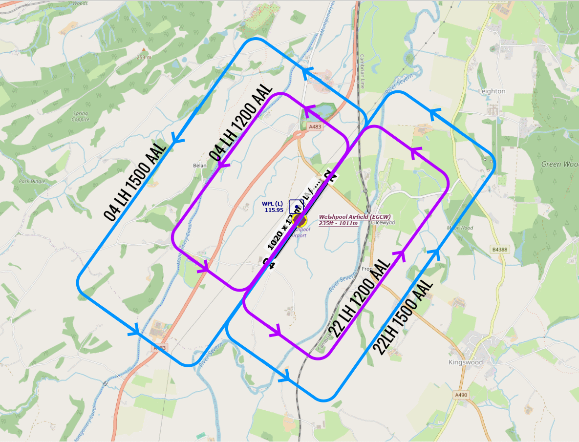
Wide circuits on account of high ground E. and W.
Overhead joins 2,500' QFE
loop Circuit & Procedures
Fixed wing circuit height 1500 aal QFE.

Rotary Wing 1200ft aal QFE.

Circuits LH
report_problem Warning
The aerodrome is located in the River Severn Valley with high ground on each side of the valley. Pilots are advised not to descend below safety height until on final approach after having positively identified the runway.


The fins of aircraft parked on the Southern Apron may infringe the aerodrome transitional area.


Trees infringe the transitional surface by 16 M, east-southeast of the aerodrome:


Single oak tree located 130 M south east of the centreline, 400 M from the north eastern end of the runway, 23 M tall;


Row of poplars located 120 M south east of the centreline, 345 M from the south western end of the runway, 34 M tall.


Runway 04 Procedure – Aircraft holding on the far end turning pad are to hold at marker board Charlie. Landing aircraft are to note that any aircraft holding at Charlie will be abeam the undershoot, separated by 70 M from the displaced threshold.
link External Resources
image Images
Ground Layout:
Circuit Diagram: