METAR Info
METAR EGYH 270950Z AUTO 27005KT 9999 FEW110/// 17/08 Q1024
Category: VFR
Wind: 270° at 5 kt
Recomended Runway 27 based on current wind conditions, with a headwind component of 5 kt and a crosswind component of 0 kt.
EGBT - Turweston
location_onLocation: 2 nm E of Brackley
mapMap: Open in Maps
settings_input_antenna Comms
Turweston Radio 122.180
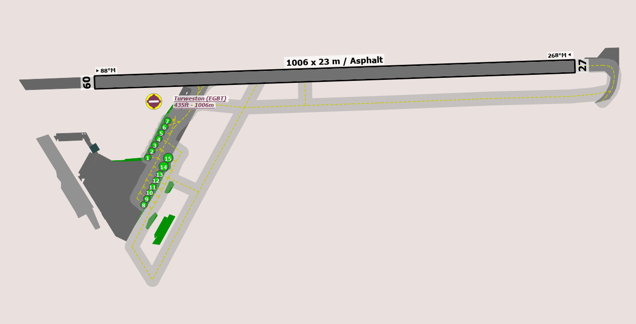
road Runways
Length: 1006 m (3300.52504 ft) close_small 23 m (3300.52504 ft)
Surface: Asphalt
Headings: 268,88
| Runway | Surface | Length | Width | Lighting | TORA / LDA |
|---|---|---|---|---|---|
| 09 / 27 | Asphalt |
1307 m 4288.05788 ft |
23 m 75.45932 ft |
Nil |
TORA: 1300 m (4265ft) LDA: 1300 m (4265ft) TORA: 1300 m (4265ft) LDA: 1300 m (4265ft) |
altitude Elevation & Pressure
Altitude: 438 ft AMSL
QFE Available: Yes -- Estimated QFE: 1024 hPa
Transition Altitude: 3000 ft
description Airfield Notes
Pilots may clear the runway by taxiing to the end (runway 27) or backtracking (runway 09). The parallel grass taxiway / runway may also be used. Any strobe lights used should be switched off upon vacating the runway.


Orbits for spacing are permitted.

Pilots are responsible for their separation.


Turning area for Rwy 27 is part of the active runway and must not be used as a hold.
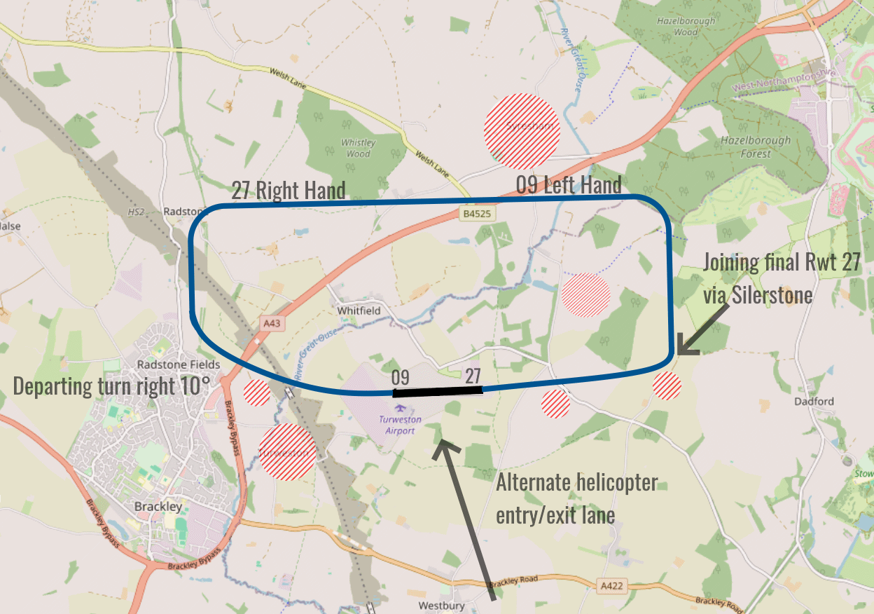
loop Circuit & Procedures
Circuit Height 1000ft QFE.

Rwy 09 - LH.

Rwy 27 - RH.
flight_land Arrival
Rwy 09 fly final approach offset 15° to the north of the runway from the A43 and avoid the villages Turweston and Whitfield. Rwy 27 On the base leg keep east of Whitfield Wood. Fly final approach offset by 10° to the north of the centerline avoiding Evershaw Farm.
flight_takeoff Departure
Rwy 09 final approaches offset by 15° at the end of the runway. Maintain track 080° to pass north of the Evershaw farm and south of the Whitfield wood avoiding the hamlets of Wood Green and Biddlesden before turning north (1.4 nm). Rwy 27 Turn right 15° at the end of the runway. Maintain track 285° until passing the A43 and avoid the villages of Turweston (South_ and Whitfield (North)
warning Caution
Pilots should familiarise themself with the noise abatement procedures below
report_problem Warning
Remain within the marked manoeuvring area.

Subject to availability and suitability aircraft may land and take off on the grass runway/taxiway.


Intensive parachuting activity at Hinton-in-the-Hedges, 4 nm SW.

Danger area EG D129 (Weston-on-the-green) active H24.

Radio Mast 232° to 220°, 680 ft amsl, 3.5 nm.

HT cables run NW/SE 1 nm west of the aerodrome.

Solar farm on approach to Rwy 09.
link External Resources
image Images
Ground Layout:
Circuit Diagram: