METAR Info
METAR EGNJ 271020Z COR 34006KT 300V010 9999 FEW040 17/09 Q1025 NOSIG
Category: VFR
Wind: 340° at 6 kt
Recomended Runway 28 based on current wind conditions, with a headwind component of 3 kt and a crosswind component of 5.2 kt.
EGBR - Breighton
location_onLocation: 0.4 nm NE of Breighton.
mapMap: Open in Maps
settings_input_antenna Comms
Breighton Radio 129.805
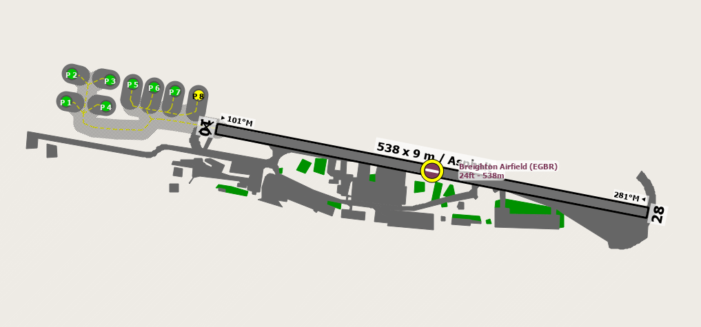
road Runways
Length: 538 m (1765.09192 ft) close_small 9 m (1765.09192 ft)
Surface: Asphalt
Headings: 281
| Runway | Surface | Length | Width | Lighting | TORA / LDA |
|---|---|---|---|---|---|
| 10 / 28 | Grass |
802 m 2631.23368 ft |
45 m 147.6378 ft |
Nil |
TORA: m (0ft) LDA: m (0ft) TORA: m (0ft) LDA: m (0ft) |
altitude Elevation & Pressure
Altitude: 20 ft AMSL
QFE Available: Yes -- Estimated QFE: 1025 hPa
Transition Altitude: 3000 ft
radio Navaids
Name: OTR
Frequency: 113.9 kHz
Notes: R283 30DME
description Airfield Notes
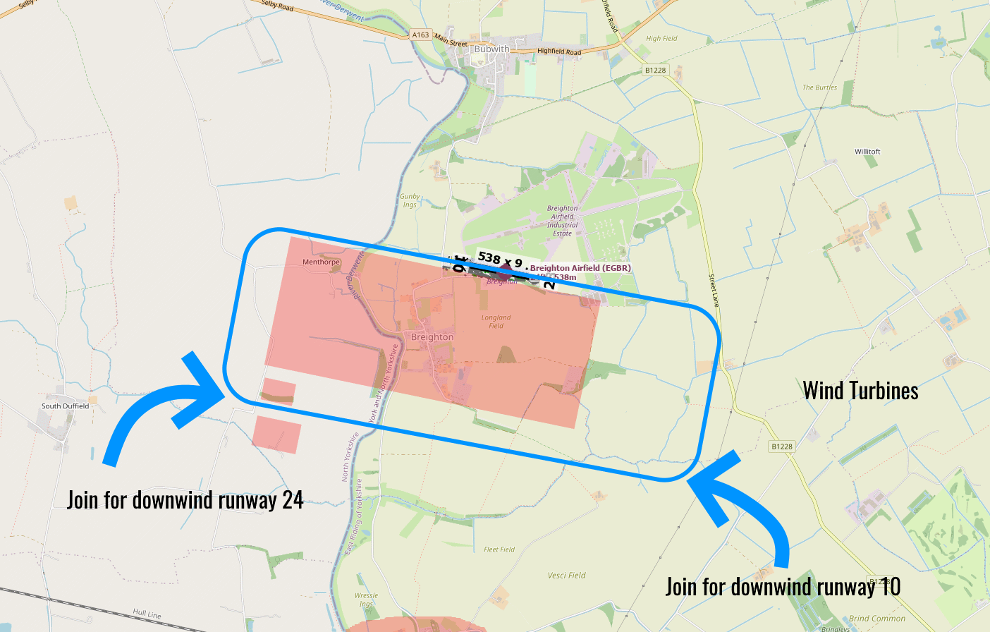
Avoid overflying the villages of Breighton, and Wressle to the south, farm buildings to the South West and Bubwuth Village to the North.
loop Circuit & Procedures
Circuits at 1000 FT AAL

Rwy 10 - RH.

Rwy 28 - LH.
warning Caution
Possible turbulence from hangers with southerly winds.

The runway is difficult to see from the south so the Preferred join procedure see circuit information.
link External Resources
image Images
Ground Layout:
Circuit Diagram: