METAR Info
METAR EGVA 290654Z 05015G21KT 9999 CLR 10/04 A3023 RMK SLP241 T00990043 RVRNO $
Category: VFR
Wind: 50° at 15 kt
Recomended Runway 08 based on current wind conditions, with a headwind component of 13 kt and a crosswind component of 7.5 kt.
EGBP - Kemble
location_onLocation: 1.3 nm W of Kemble.
mapMap: Open in Maps
settings_input_antenna Comms
Kemble Radio 118.430
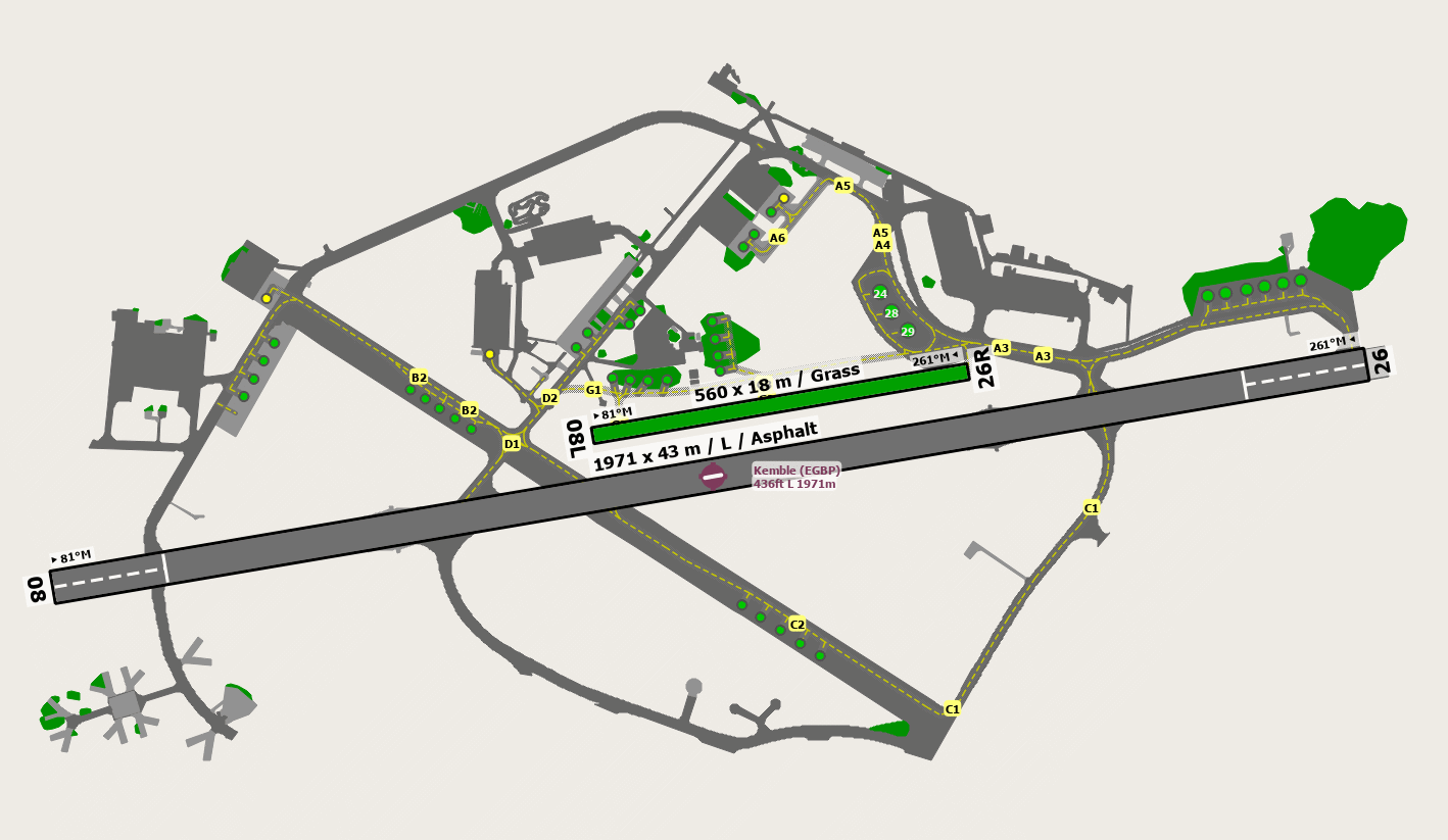
road Runways
Length: 1971 m (6466.53564 ft) close_small 43 m (6466.53564 ft)
Surface: Asphalt
Headings: 261,81
| Runway | Surface | Length | Width | Lighting | TORA / LDA |
|---|---|---|---|---|---|
| 08 / 26 | Asphalt |
1972 m 6469.81648 ft |
43 m 141.07612 ft |
Thr Rwy APAPI 3° |
TORA: 1759 m (5771ft) LDA: 1778 m (5833ft) TORA: 1799 m (5902ft) LDA: 1640 m (5381ft) |
| 08 / 26 | Grass |
561 m 1840.55124 ft |
18 m 59.05512 ft |
Nil |
TORA: 561 m (1841ft) LDA: 561 m (1841ft) TORA: 561 m (1841ft) LDA: 561 m (1841ft) |
altitude Elevation & Pressure
Altitude: 436 ft AMSL
QFE Available: Yes -- Estimated QFE: 1024 hPa
Transition Altitude: 3000 ft
radio Navaids
Name: CPT
Frequency: 114.4 kHz
Notes: R289 33.2DME
description Airfield Notes
Joining:

Fixed wing should join overhead 2000ft QFE 2500ft QNH


Departures:

GA aircraft are requested not to climb out straight ahead on departure.
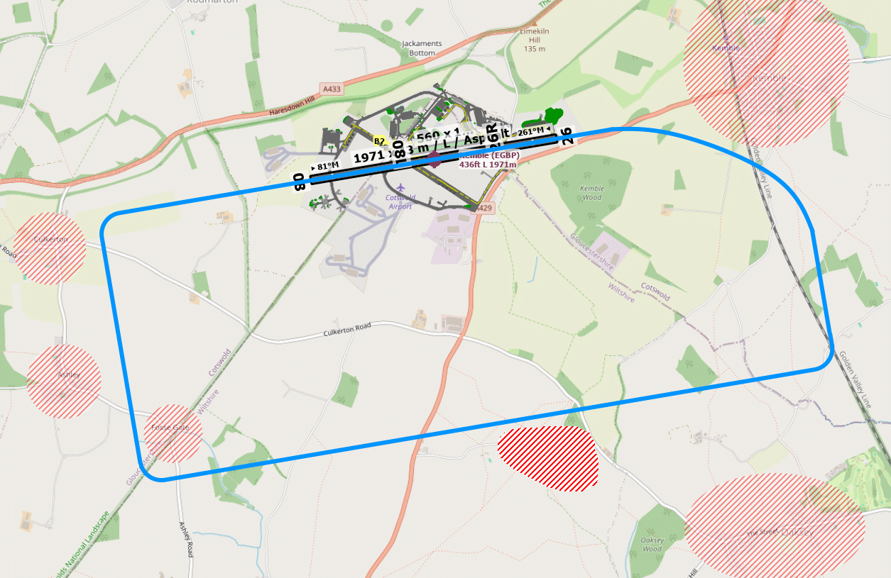
loop Circuit & Procedures
Fixed wing: Circuit height is 1,000ft QFE

Helicopters: Circuit height is 700ft QFE

Jets: Circuit height is 1,500ft QFE


All circuits are to be flown south.

The circuit has been designed to minimize aircraft noise to residents, straight in approaches are therefore discouraged.
report_problem Warning
Aston Down: Gliders up to 3,000 ft - 3nm to the north west of Kemble

South Cerney: Occasional para-dropping up to FL130 - 3.5nm to the east of Kemble

Oaksey Airfield: Active GA aerodrome - 2.5nm to the south of Kemble
link External Resources
image Images
Ground Layout:
Circuit Diagram: